
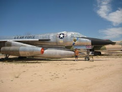
I recently obtained a few F-106 accident reports from the early 1960s. These F-106s were assigned to the Spokane International Airport.
During the Cold War, and today, really, fighter squadrons were and are stationed around the United States with the intention that they would be able to intercept incoming bombers or other threats. The F-106s (retired in 1988) were assigned to the ADC, or Air Defense Command. The reports are not complete, in that little mention is made of blame or final solution. With that in mind, I am offering my best interpretations. If someone out there finds my suppositions to be false or you have a better description, by all means please e-mail me and I will make necessary corrections. Here is the first report.
On the morning of September 14, 1961, First Lieutenant Russell C. Wood briefed for a routine target mission. This would likely have been an intercept of a B-52 training in the area. Given the location of SAC bases, the B-52 could have been from Larson AFB, Fairchild AFB, or any number of other bases in the Northwest (Idaho, Montanna...etc.). It could have also been an intercept of an EB-57 , which was used to test the Air Defenses of the Continental US, though, I believe that to be unlikely. From what I understand the EB-57s were used for training and checking the radar systems and operators, not necessarily the ADC fighters.
Airman second class Kenneth D. Hintz accompanied Wood on his walk around of F-106A #57-2484. There were no discrepancies and Hintz secured the access panels while Wood strapped in. One combustion start was attempted with no success, but a pneumatic start worked at 0915. The MA-1 power system timed in and they made various checks, then Wood taxied to the ramp. He was airborne a 0926, 6 minutes after the proposed time. Estimated fuel onboard was 8900 pounds.
.
Wood made a left turn out of traffic and began his climb on a heading of 326. The proposed flight plan was "Geiger direct 52 degrees N. 122 degrees W. (William's Lake B.C.) direct Larson TACAN, direct Spokane VORTAC." That looks like a trip to the North East to British Columbia, a turn to the South West back to Larson, then a turn to the East to end up back at Spokane. The F-106 on the same flight profile and plan 1/2 hour behind heard his check-ins via radio, but no ground stations did.
.
It was not until he was over the Larson TACAN at 1038 at FL480 (48,000 feet) that Spokan Center heard from him. He then contacted Spokane Approach Control and was positively identified on radar (No difficult feat considering there probably were not many other aircraft at FL480) and "he was cleared to the 35 mile fix of the Spokane VORTAC, report inbound." (VORTAC stands for: VHF Omnidirectional Range/Tactical Aircraft Control)
.He reported over the fix at FL200. He was instructed to report once he passed FL70. At 24 miles he was advised of traffic, a DC-6, at 14 miles West of VORTAC. At 15 miles he was dvised to begin his landing cockpit check. He reported when he passed through 7000 feet, and requested a "surveillance approach to runway 03." He was told to level off at 4000 feet and he acknowledged. Again he was advised of traffic, and told to "prepare to start his descent in 4 miles."
.
He then told RAPCON (Radar Approach Control) that he would have to break off this approach, but they did not respond. He continued his pproach, then was told to start his descent. Twelve seconds later he was told to maintain 4000 feet and turn right to 150 because of traffic. He reported steady on 150, and then was told to turn to 205 and maintain 4000. 30 seconds later the tower observd him continue turning past 205. They asked if he was continuing this appoach on his own, to which he replied, "Negative, I would like a surveillance approach to runway 03." They told him to stop his turn and then proceeded to give him a "no-gyro" approach. At 5 miles he was told to begin his descet. Radar contact was lost at three miles, which was normal considering ground clutter.
.The aircraft crashed 2.4 miles from the runway on a heading of 063 degrees true. The smoke was observed from Spokane Tower at 1102. Wood ejected, but unsuccessfully from an altitude of 200-500 feet above the ground.
.The report ends with the summation that there was no indication of emergency from Wood. It does not state what caused the crash. It does not go into anything else. Simply the flight description. This, in the my world of aircraft accident reports, is annoying, since others generally have a page where a determination of cause is surmised if it isn't known.
.
As an unqualified observer from almost 50 years on, I offer my supposition that it may have been possible for his J-75 to flame out. I don't know what would have caused a flame-out, though. Perhaps he retarded the fuel flow for a moment or there was a stuck valve. Did he suffer a bird strike? Until the rest of the report is released or someone comes forward with a better idea, that is what we are left with.
.
The picture of the crash site and this ground track are all that is included with this report. On the map you can make out the B-52 and KC-135 shapes to the left where Fairchild is, and the F-106 and civil aircraft shapes at Spokane International.

Note: On 30 August 1956 the Air Coordinating Committee approved a common military-civil short-range air navigation system called VORTAC, which combined TACAN with the Civil Aeronautic Authority's very high frequency omnirange direction finder. see link at left.
Note: TACAN stands for Tactical Air Navigation. see wikipedia link at left.


6 comments:
Remember a jet crash in the early 60s not far from my house. I believe this might be the one that I remember. Only thing that doesn't add up is the crash site. If this is the one I am thinking of, the crash site was more to the east of the Spokane International Airport...on the hill above the Fitch Arboretum. Am I thinking of a separate crash, or is perhaps your location on the map you posted incorrect?
Additionally, if I use SIA runway 03 as my center point, I can draw an arc on a map from where your crash site is circled and it intersects almost exactly where the crash site that I am thinking of was. Coincidence? Also, I seem to remember that the talk was that the plane was inverted and that the pilot rode the plane into the ground knowing that ejecting as close to the ground as he was meant certain death. There was a fairly good size crater where the jet impacted and it did take out a house that was there. I remember a military ambulance there and a soldier with a pair long forceps picking up things out of the ground and placing them in a long white drooping cloth bag that was dripping with what I could only describe as isopropyl alcohol.
Ken, it could be a different crash or it may be the same. Do you have a specific date? I can look it up in my lists and see. I think there were a few out of Geiger that were lost. Accident reports are sometimes inaccurate or omit things. I will see what I can do. Feel free to email me (off to the right side of the screen)
Jimh.
Tried the link, my computer would not allow it to open [just went from dial up to cable ?]. If you would, send your email to knndriver@gmail.com and I will give you all the information that I have or can remember. I can pretty much pin-point the crash site although from google maps, newer houses are there now. You have to keep in mind I was about 6 or 7 years old at the time, but the imagines are still fairly clear.
Russell C. Wood is my Grandfather!
I have never known such details of his passing and I appreciate the information.
Any new information?
I'm sorry for your loss. I'm grateful that this has help. I've been out of the aircraft accident chasing business since becoming a parent. Also I have a full time job teaching history to fourteen year olds. I'll see if I can dig something up from my old files but I don't promise anything.
Post a Comment